Flood protection in Kampen - Nov. 19, 2024
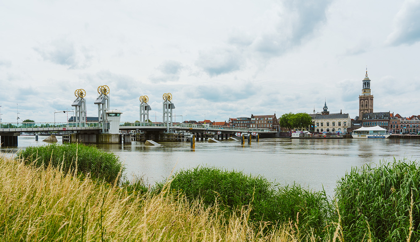
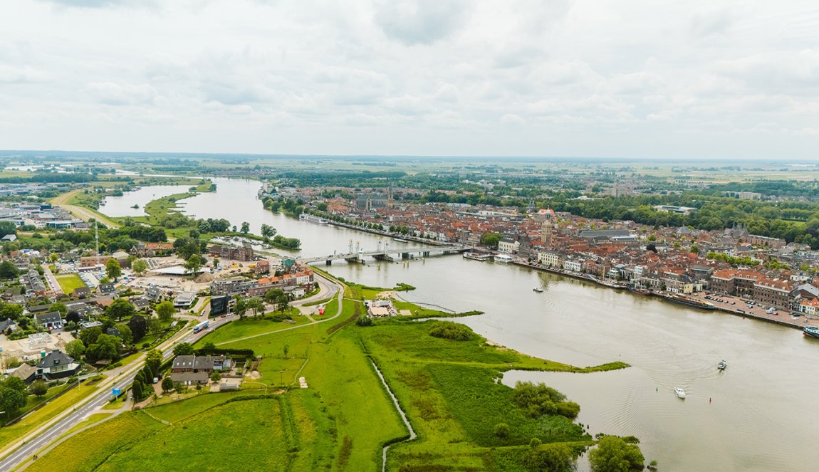
The Dutch Hanseatic city of Kampen is facing an age-old but increasingly urgent threat: the unstoppable power of water. Like a silent guardian, the city rises at the mouth of the mighty IJssel in the province of Overijssel in the east of the Netherlands. A river that already provided habitat and trade in Hanseatic times, but also brings with it the constant danger of flooding.

Surrounded by a network of rivers, canals and polders that once secured the city's wealth, Kampen could quickly fall victim to its own geographical location. Climate change is increasing the challenge of adequately protecting oneself from the floods. For the city administration of Kampens, the question of water management is of outstanding importance. The geographical and climatic conditions make Kampen particularly susceptible to flood events, so the city is relying on innovative protective measures.
Why is Kampen worried about flooding?
Kampen, with its approximately 55,000 inhabitants, is located in one of the lowest regions of the Netherlands. Large parts of the city and its surroundings are below sea level. This geographical peculiarity makes them extremely susceptible to flood events. Increasingly frequent periods of heavy rainfall further exacerbate the risk of flooding. Particularly problematic is the situation on the IJssel, one of the country's most important waterways, which directs large quantities of water towards the IJsselmeer.
Especially in combination with storm surges, the water in the IJssel can rise dramatically and threaten the surrounding area of Kampen. To counter this threat, Kampen has implemented a series of flood protection measures that combine technical and natural solutions. For example, Kampen is participating in the "Space for the River" (Dutch: Ruimte voor de Rivier) project, which is being implemented in several Dutch cities and aims to give rivers more space during floods.
In Kampen, the focus is on measures that increase the capacity of the IJssel River, so that larger quantities of water can be absorbed without flooding the city. This is done through various interventions in the river landscape and adjacent areas: In certain sections of the IJssel, the riverbed has been widened to accelerate the flow of water and prevent damming that could otherwise lead to flooding.
In addition, flood plains have been created, such as in Reevediep. This seven-kilometre-long diversion canal connects the IJssel with the Drontermeer and can drain off excess water during floods. The Reevediep thus acts as a buffer and can significantly reduce the pressure on the dikes along the IJssel. At the same time, it is an example of the renaturation of river landscapes and promotes the natural buffer capacity of the river.
"The restoration of natural riparian regions with floodplains and wetlands increases the buffer capacity of the river," explains Stan Vergeer, water management expert for the municipality of Kampen. "These measures promote infiltration and slow down the flow of water, which reduces the risk of sudden flood events." In addition, new habitat for numerous animal and plant species will be created, which will be used as a local recreation area and for activities such as hiking and cycling trails.
Locks and weirs regulate the water level

The Reevediep is also equipped with locks and weirs that regulate the flow of water. These structures make it possible to precisely control the water level and allow flooding in controlled areas, while protecting inhabited areas. One of the most remarkable measures is the construction of mobile flood barriers. These can be quickly erected by a task force of local volunteers in the event of imminent flooding.
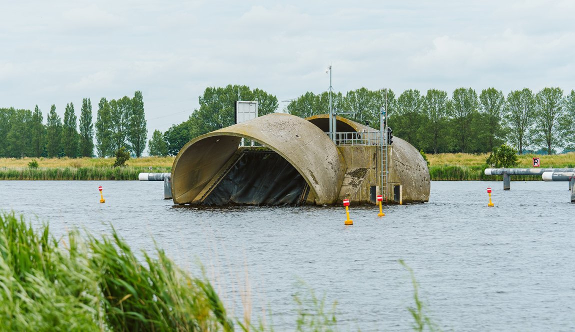
These mobile flood barriers offer the possibility of flexibly protecting certain districts or regions, depending on the flood scenario. Additional protection is also provided by the so-called Ramspol bellows dam (Dutch "Balgstuw Ramspol"), which lies between the IJsselmeer and the Ketelmeer, an inland body of water near Kampen. This barrier is an inflatable barrier consisting of three huge rubber tubes stretched side by side across the water.
These bellows are usually empty and lie flat on the bottom of the canal, allowing shipping traffic to pass unhindered. In the event of a storm surge, the system is activated by filling the bellows with air and water, which takes about 90 minutes, explains Stan Vergeer. When filled, the hoses rise out of the water, forming a barrier that extends across the entire width of the waterway, a total of 240 meters long and ten meters high.
Advantages and significance of the Ramspol bellows barrier
The Ramspol barrier is unique in the world and offers several advantages over traditional storm surge barriers: Since the barrier is only activated when necessary, the waterway remains open for shipping in its normal state. "It can be activated quickly and effectively at the touch of a head and impresses with its cost-benefit ratio: Compared to fixed barriers or dams, Ramspol is more economical because it is only used when needed," says Vergeer.
The various protective measures in and around Kampen show how a combination of innovation and renaturation can make the fight against flooding efficient and sustainable. The versatile water management also creates new habitats for flora and fauna and increases the quality of life of the residents through attractive recreational areas. Kampen is thus adapting to the challenges of climate change and at the same time securing a liveable space for future generations.